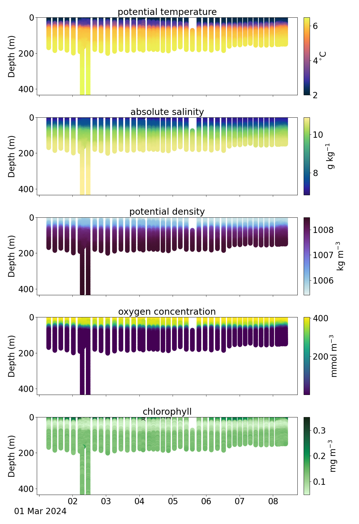
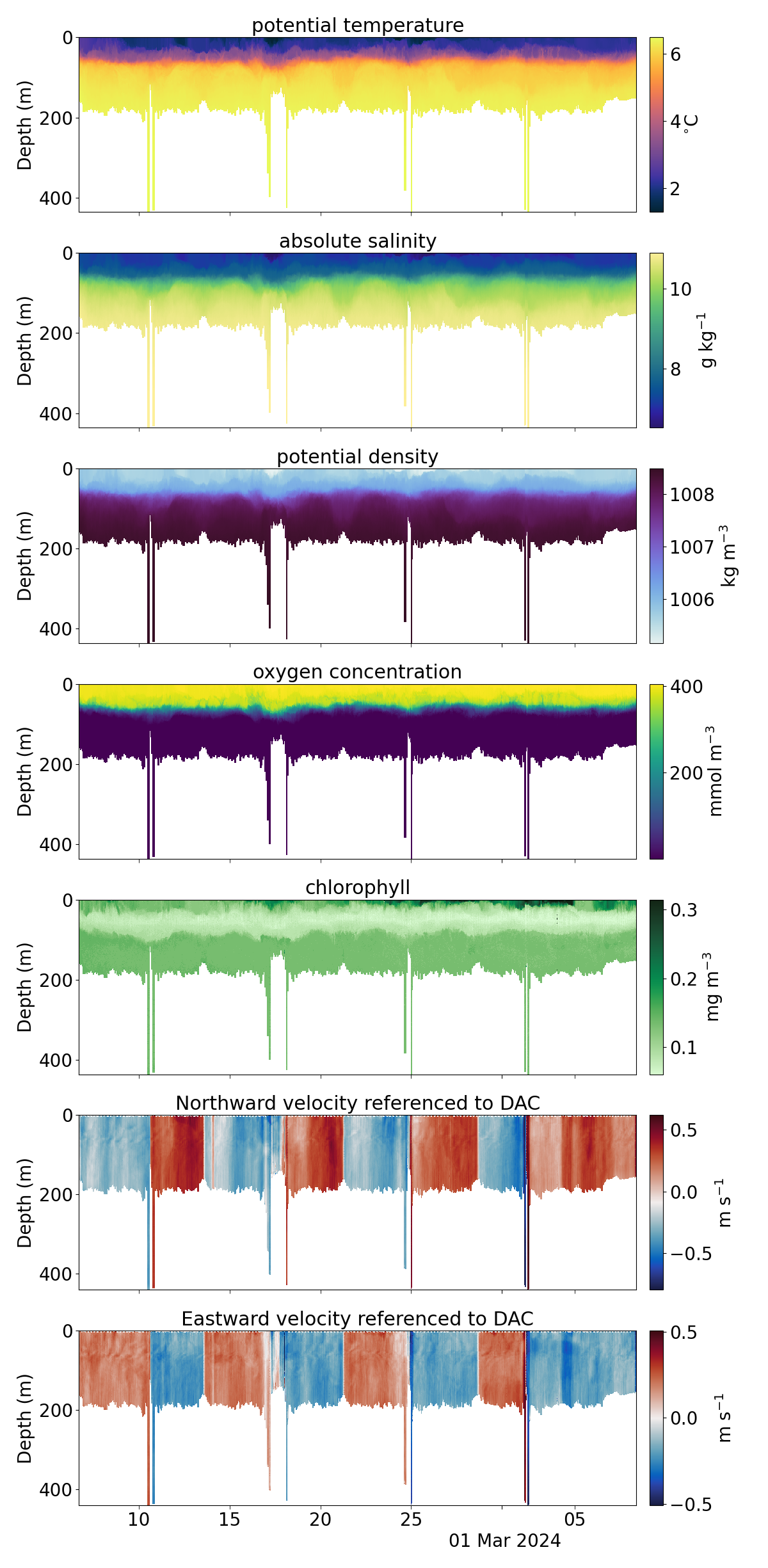
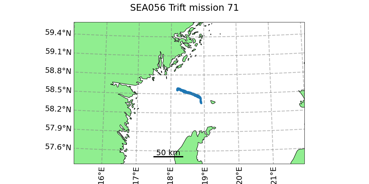
SEA056 Mission 71
This mission was in Western Gotland Basin as part of the SAMBA project.
All missions from this glider: SEA056 page
Start: 2024-02-06
End: 2024-03-08
Download data: https://erddap.observations.voiceoftheocean.org/erddap/tabledap/delayed_SEA056_M71.html
Comment: Altitude set to 2m for the entire mission. Zt/zs set to 2m for the entire mission duration apart from a few dives with zt=15m between C324 and C329. Glider hit the seabed one time at C229 and C436
Please acknowledge data used in any publication with the following statement:
This study used data collected and made freely available by Voice of the Ocean Foundation (https://voiceoftheocean.org) accessed from https://erddap.observations.voiceoftheocean.org/erddap/index.html
Full interactive plots on the dashboard: Dashboard for SEA056 Mission 71
nrt scatter